You Don't Have to Go Far to Have Fun
Hiking and dispersed camping in Flagstaff, AZ
It’s no secret that gas prices have risen; it’s over $4 everywhere I’ve seen. The other day Sean filled up at $4.99/gallon. With that in mind, we decided that this summer will be a “go play in the backyard” kind of summer with a few larger trips mixed in.
Luckily, our “backyard” is filled with so many fun things to do! Within a 2 hour drive of Flagstaff, there’s 10 NPS sites and 5 National Forests, which means lots of hiking and camping.
Last week, we both had Thursday and Friday off. Thursday became a chores day so we were left with Friday for some fun. We loaded up the truck and headed to the forest for a hike.
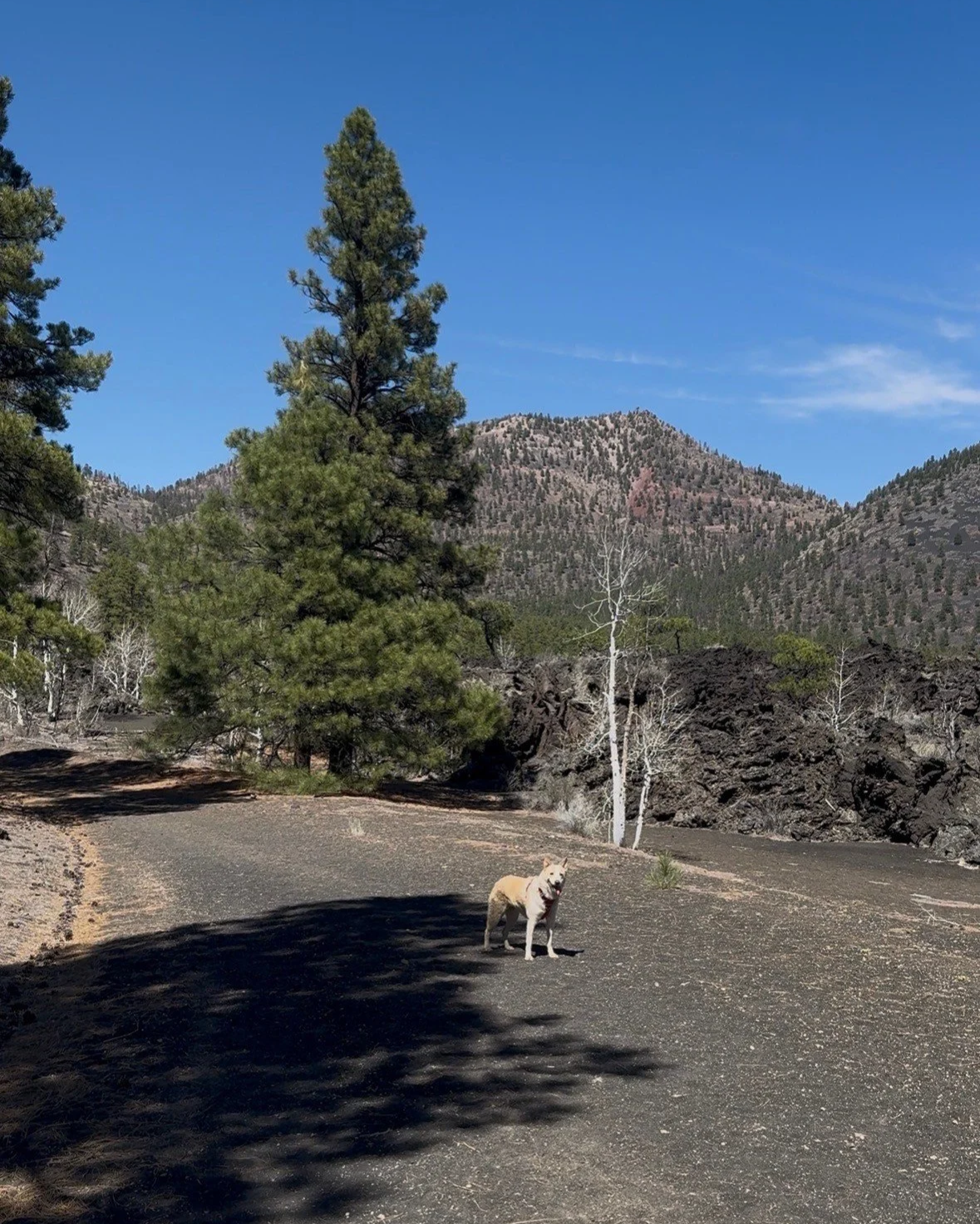
Riv posing in front of O’Leary Peak
O’Leary Peak is a lava dome volcano at 8,916 feet elevation in the Coconino National Forest. The hike to the top of the peak, where an old forest lookout station sits, is 10 miles out and back, has 2,027 feet of elevation gain, and rated hard on AllTrails. It is also the only place where you can look into the crater of Sunset Crater Volcano, the National Monument that borders the Coco NF. Sunset Crater is the youngest volcano in the San Francisco volcanic field, which is made up of over 600 volcanoes spanning from Winslow to Williams. The most notable of these is the San Francisco Peaks, or “The Peaks” as referred to by locals. It consists of four peaks with Humphreys Peak at 12,633 ft elevation, the tallest mountain in Arizona. Long ago, they were even mightier. The Peaks are a stratovolcano and estimated to have been almost 4,000 ft taller than they stand today. Either it blew out its top in a violent explosion, or it sank in; that’s still up for debate.
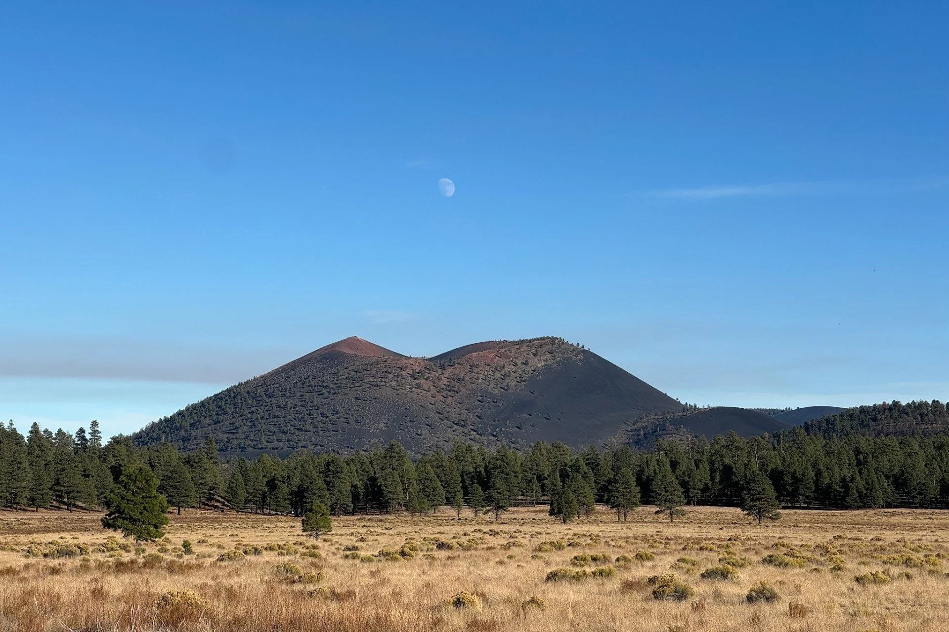
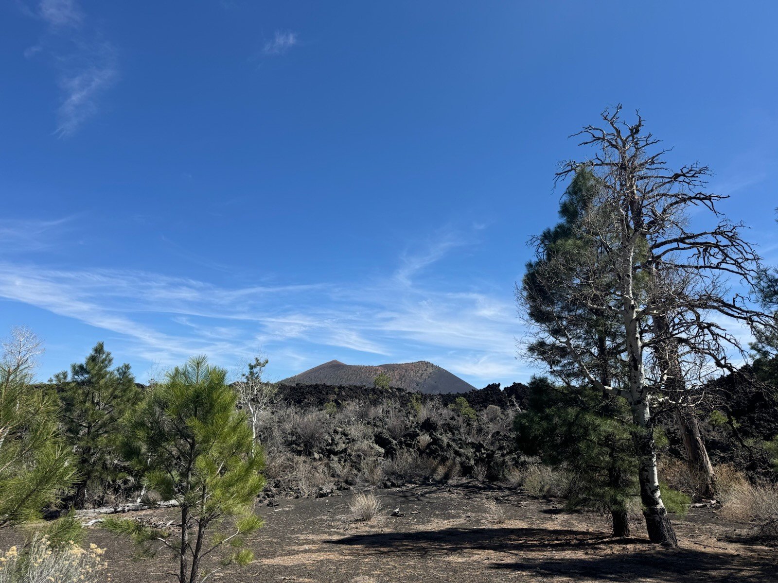
Sunset Crater Volcano viewed from Bonito Park
Sunset Crater is a cinder cone volcano and a majority of visitors to the National Monument expect to see a crater similar to Meteor Crater about 50 miles away in Winslow. But unlike Meteor Crater, an impact crater from a meteor that fell to the earth's surface, Sunset’s crater is located 1,000 feet above the trails at the top of the volcano. Cinder cone volcanoes erupt spewing cinders from its vent, and in doing so, create a cone shape. When the explosion is all done, the top of the volcano is a rim circling a bowl where the vent was, creating a type of crater. When you are in the park, you are walking through the Bonito Lava field at the base of the volcano. The crater cannot be observed from inside the park as there is no off trail hiking which includes no hiking on the volcano. You can see the shape of the crater from the profile of Sunset. One of the best places to see this is actually outside of the park in the Coco NF, at Bonito Park. You also get a great view of The Peaks there.
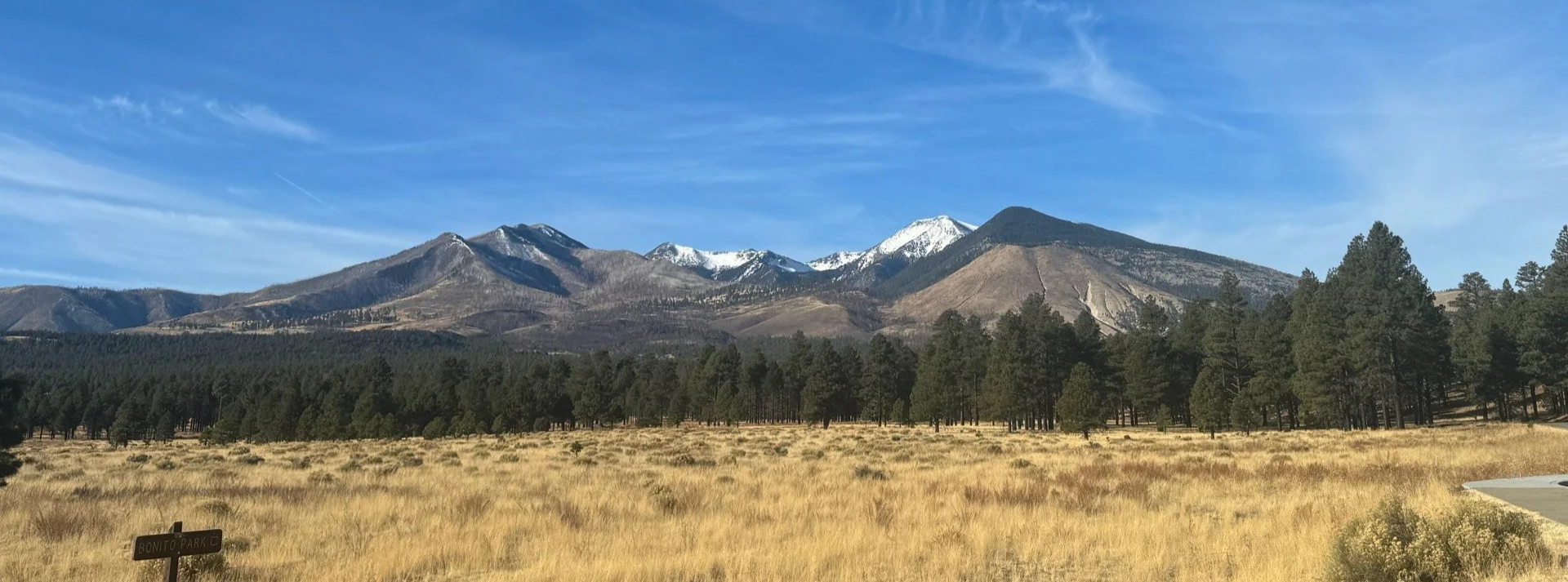
The Peaks viewed from Bonito Park
Having worked three winter seasons at the Flagstaff Area National Monuments, I have always wanted to hike up O’Leary to look into Sunset’s crater. Sean and I decided that the day had come to do just that. We packed up the truck with everything needed to hike and also camp out for the night and headed to the forest.
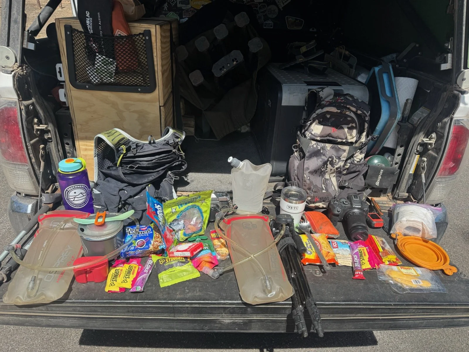
All the goodies we packed for the hike
At the trailhead we got our packs together, started Strava, and headed up the trail. It's an old forest road that climbs the mountain to the lookout tower so it's a bit different from more traditional 2 foot wide trails in the forest. We enjoyed walking side by side and allowing Riv to hike off leash. The trail has steady elevation gain as you start and is all cinders, which is like walking on the beach. To distract from our heavy breathing, we pointed out to each other any time we could see the lookout station, Sunset Crater Volcano, or any cool volcanic features.
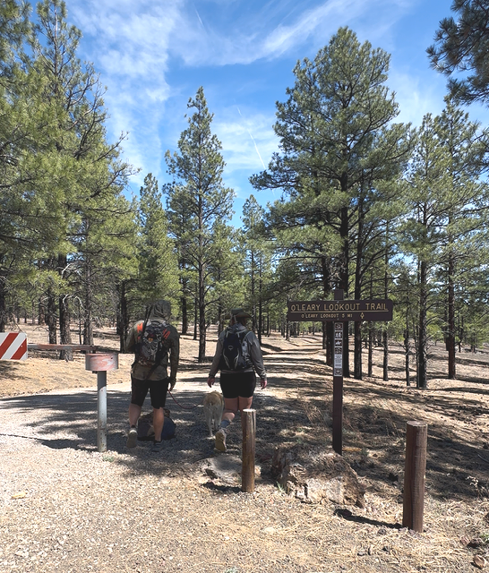
O’Leary Trailhead
While the views were beautiful, we got about a mile and a half in and just weren’t feeling up for the hike. Sean’s knee was bothering him, I was stressed about the time it may take to summit and get back to camp in time for the sunset, and Riv was panting heavier than normal. We decided to turn around.
Sunset Crater Volcano viewed along O’Leary Trail
This was new for us. If we set a goal or make a plan, we do everything in our power to stick to it. So bailing on a hike that was 5 miles to the summit after 1.5 miles felt very foreign. It also felt freeing though. Sometimes when we reflect on our trips, we realize we weren't enjoying ourselves as much as we had hoped. Recognizing in the moment that none of us were really feeling it and deciding to cut the hike short was a really great growth moment in our relationship.
On the way back to the truck, we enjoyed the elevation loss that we had been pushing ourselves up just before. We got some great views of The Peaks and talked about how cool the views must be higher along the trail, agreeing that we both want to come back and attempt it again, just maybe starting much earlier in the day so it's not as hot and we don’t feel so stressed on time.
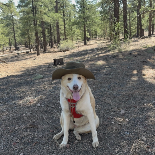
Ranger Riv keepin’ it real
With a few hours left before we wanted to arrive at camp, we decided to drive through Sunset Crater Volcano NM and visit Wupatki National Monument, about 30 mins north on the loop road. Wupatki NM is an indigenous cultural site that was built and inhabited by the Ancestral Puebloan people less than a thousand years ago.
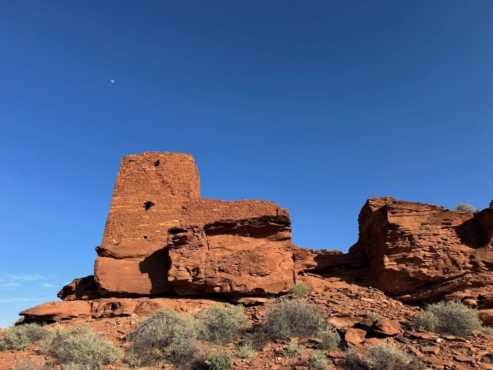
There are 4 pueblo sites consisting of 7 different pueblos you can visit. The largest is Wupatki, located behind the visitor center. It is a 100+ room pueblo with a community room and ball court. There is also a blow hole at the end of the trail, a unique geological feature that either blows out or sucks in depending on the pressure inside the fissure compared to the outside air pressure. Visitors often take off their hat and hold it over the blow hole to see which direction the air is moving and how strong it is. Wupatki is the largest pueblo within a 50 mile radius and was the main trading hub of the Ancestral Puebloans. It is a very impressive structure and so beautiful to see. Even more impressive to think of the lives that were lived there. They spent their days hunting and gathering food, gathering and transporting water, crafting clay pots and yucca sandals, and trading goods. They were very strong, smart people who knew the value of community and their role to play.
There was scaffolding up around the pueblo when we visited. NPS has that up in an effort to stabilize a wall that’s showing signs of movement and likely would fall without the support. Archaeological practices have changed over the years and rebuilding structures isn’t the norm anymore. Instead, parks attempt to monitor movement and stabilize the walls when they are showing movement. While this may not provide the most ideal viewing of the pueblo, it is important to its preservation.
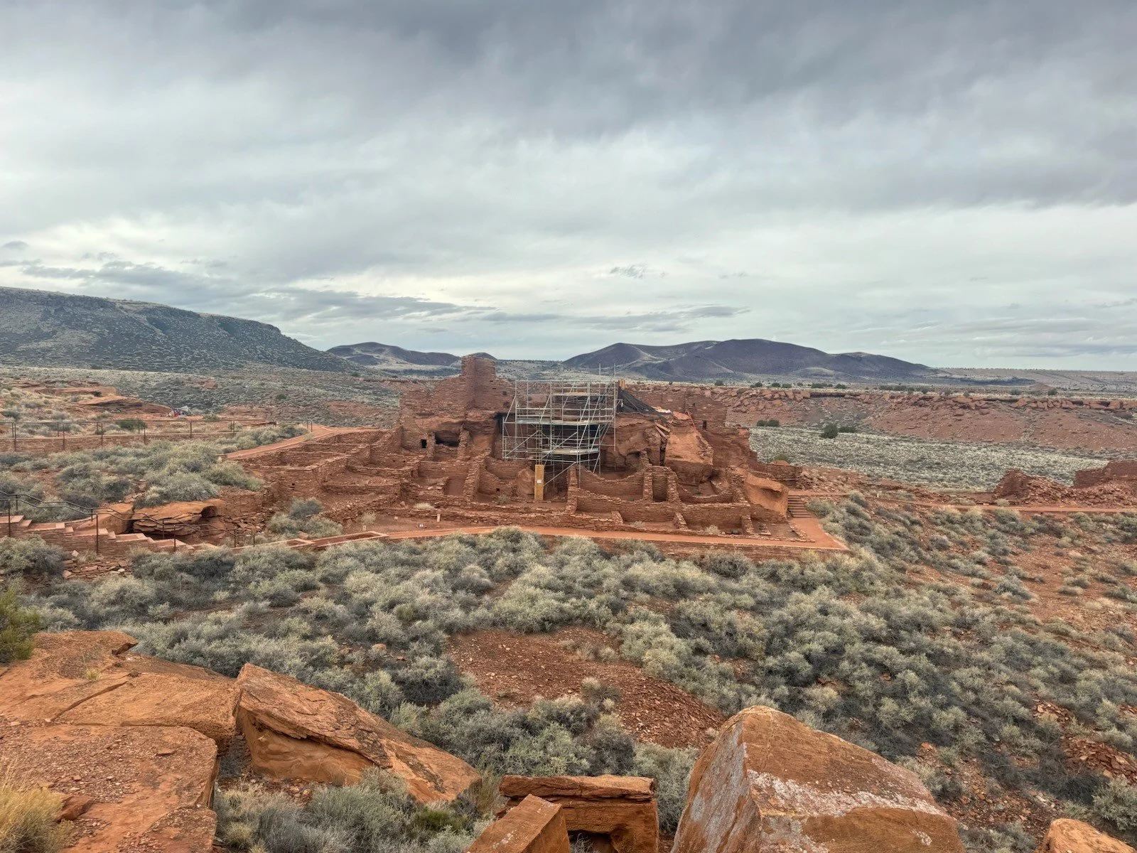
Wupatki Pueblo being stabalized
While Wupatki is the largest pueblo and most popular stop for visitors, my personal favorite is Wukoki Pueblo. It is located about 5 minutes from the visitor center on its own road, Wukoki Rd. As you're driving to the trailhead, you start to see Wukoki in the distance. It is a three story tower pueblo built on a sandstone outcropping. You get a great view from the parking lot and it's only .2 miles to hike to, inside, and around the pueblo. I love how it was built, appearing to rise right out of the sandstone. The color of the red walls against the almost always bright blue skies of Arizona is such a beautiful contrast. Walking inside the pueblo provides a really neat perspective of the view of The Peaks that the inhabitants once had.
Wukoki Pueblo
Please visit with care and consideration of the spiritual value of these ancestral sites. Stay on trail, pack it in and pack it out, take nothing but photographs, leaving everything in its place for others to enjoy, and do not touch, sit, or climb on any of the walls. The thirteen associated tribes believe their ancestors still live at Wupatki. Please be respectful.
After our visit at Wupatki, we headed south on the loop road back towards Sunset. The Coco NF surrounds the two National Monuments, providing great opportunities for dispersed camping. Dispersed camping is free, dry camping often allowed in National Forests and BLM land. There are rules and restrictions and popular areas like Sedona have designated dispersed camping. Generally, you are allowed to camp off FS & BLM roads as long as you park on previously disturbed areas and are within 300ft of the road. It's important to visit the official website of the NF or BLM that you intend to camp in, to ensure you are legally camping. Fines are high and restrictions are set to protect the public land. For the Coco, check out the rules here: https://www.fs.usda.gov/r03/coconino/search?s=dispersed+camping
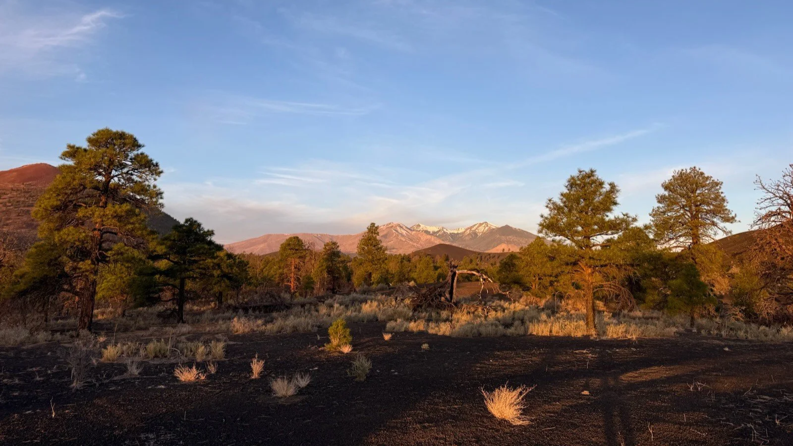
The view from camp. San Francisco Peaks, center, and Sunset Crater Volcano, left.
We found a spot with a great view of The Peaks and took a few minutes to determine the most level spot to park. Sean shoveled the cinders a bit to make the truck perfectly level, then we popped the top, made the bed, and set up camp. We have a 2 ½ person camp chair that comfortably fits the two of us plus Riv. I put that out along with our camp table. Then we started on dinner while enjoying a beautiful sunset.
Sean did the grocery shopping the day before and picked us up stuff to make burgers and a pasta salad. We got water boiling and started cutting up veggies: cucumbers, carrots, and celery. The pasta was set to the side to cool and Sean got to chefing up our burgers, beef for him and impossible beef for me. Riv had been laying on her bed that we set out for her, but happily joined me walking around camp to collect firewood. There was a dead, burnt tree about 50 feet from camp. I went back and forth collecting small, medium, and large sized branches from the dead tree and dug out a fire pit next to our camp chair. I assembled the fire and with one click of the lighter, it began to glow.
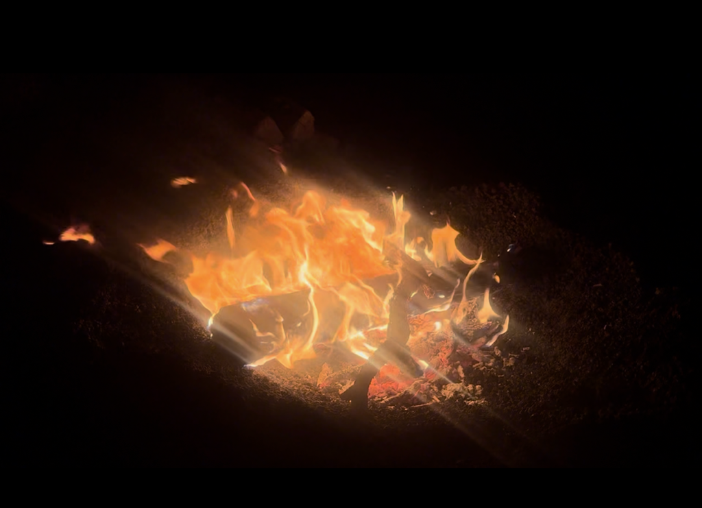
The west has fire restrictions for most of the summer as it's so dry and wildfires can spread very fast. Please check the status of restrictions and be ready to put out a fire before lighting it, with a shovel and bucket of water close by. Never leave a fire unattended and when you are done drown, stir, and feel fires to ensure it is cool to the touch before leaving it. There have been so many times when we were driving down forest roads and found unattended fires that we stopped at to put out. My name’s Smokey for a reason.
Check for updates and fire danger status for the Coco NF here: https://www.fs.usda.gov/r03/coconino/search?s=fire+restrictions
Just as I got the fire going, Sean finished cooking the burgers. We threw the veggies in the pasta, dressed it with Olive Garden Italian dressing, plated everything, and sat next to the fire. By this time, the sun had set and the stars were coming out. It was a lovely little dinner, perfectly capping off our day. We cleaned up and put the table away. Then we cuddled in the camp chair for over an hour in the glow of the fire. We found great joy in watching the stars slowly dance across the sky and seeing the moonlight reflect off the snow on The Peaks. If we had to describe our perfect night, it's pretty much this. I am so grateful we found companionship within each other, that we share the same idea of the perfect date night, vacations, and life goals. How lucky are we?
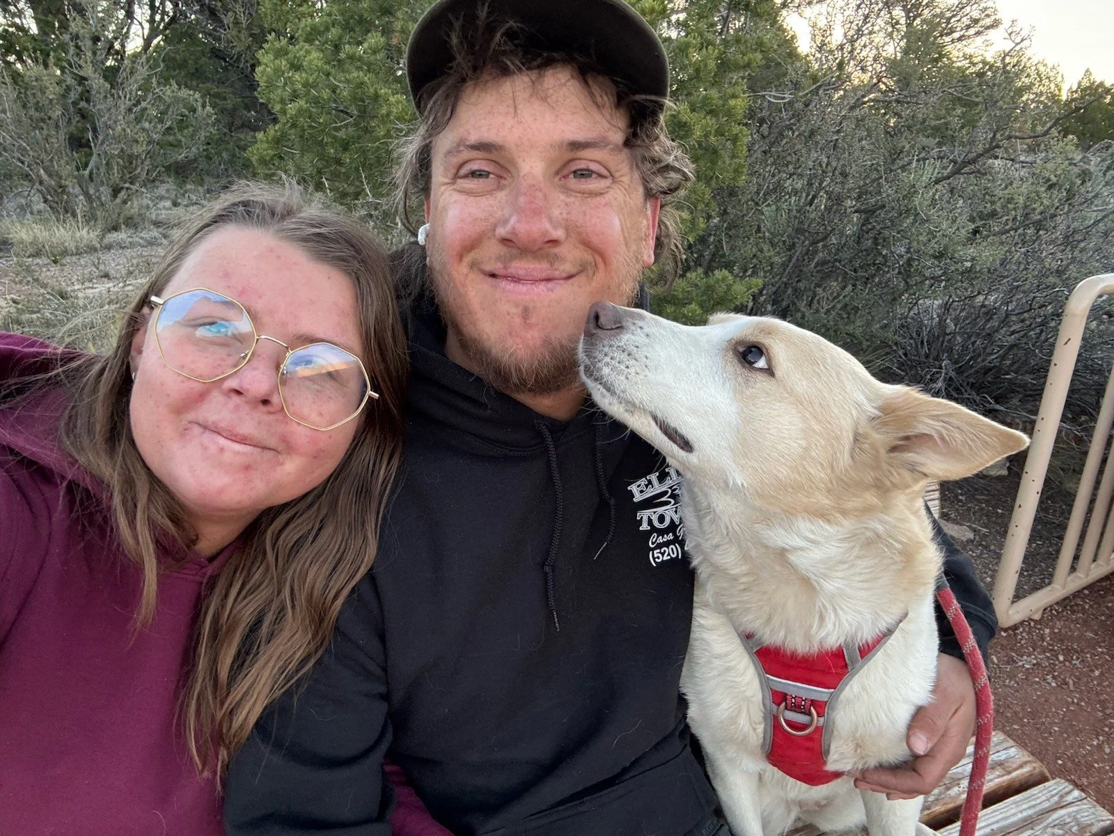
Sean, Riv, & me
Watch the sunset, the fire burn, and the stars glide across the sky in this timelapse: https://www.instagram.com/reel/DWxIrpsEqJ7/?igsh=ZmUyeWc2MTNjYzNl
We drove a total of 65 miles and spent $40 on groceries and had ourselves a great 24 hours just north of town. When you are looking to get out this summer, don’t feel like you have to get on a plane or do some crazy long road trip. I bet there are some really cool local gems just waiting for you to explore them. Pack up the cooler, bring a tent or sleeping pads and bags to sleep in the back of your car, and go have some fun. There is no distance requirement to adventures, just go get some sun on your (sunscreened) skin, fresh air in your lungs, and wind in your hair. You’ll be so glad you did!